
The following feature is part of a six-month series from Magic Canoe’s Contributing Writers. Four writers were selected to each cover one of four desks – Salmon, New Economies, Environment, and Indigenous Leadership. This story is the first for the Salmon contributor, Tara Lohan. Learn more about our contributing writers here. Major support for the Contributing Writers Series is made possible by a gift from Priscilla Bernard Wieden, in loving memory of Dan Wieden.
Liz Ransom stands in the middle of a bridge on Bayocean Road. She surveys Flower Pot Creek as it passes under the bridge and empties into Tillamook Bay on Oregon’s North Coast. This meeting place of seawater and fresh water forms an estuary vital for young salmon. But it’s also an intersection of road and water, which puts that prime fish habitat in jeopardy.
Rivers and streams that cascade from the Coast Range to the Pacific Ocean serve as highways for salmon. But where those watery thoroughfares intersect with our concrete ones, salmon journeys can end abruptly.
The problem isn’t unique to coastal Oregon. Across the United States are more than 6.3 million junctions where roads and waterways intersect, typically resulting in structures like bridges, culverts, or fords. The Southeast Aquatic Resources Partnership has so far assessed more than 350,000 of them and found around half are likely to impact aquatic organisms. That means presumably millions of road and stream crossings are harming fish and other aquatic animals.
Nationally, we’re only scratching the surface of fixing the problem. Around 16,000 of the problematic structures have either been removed or mitigated so far. But on Oregon’s North Coast, efforts are ramping up to add to that list—with salmon as beneficiaries.
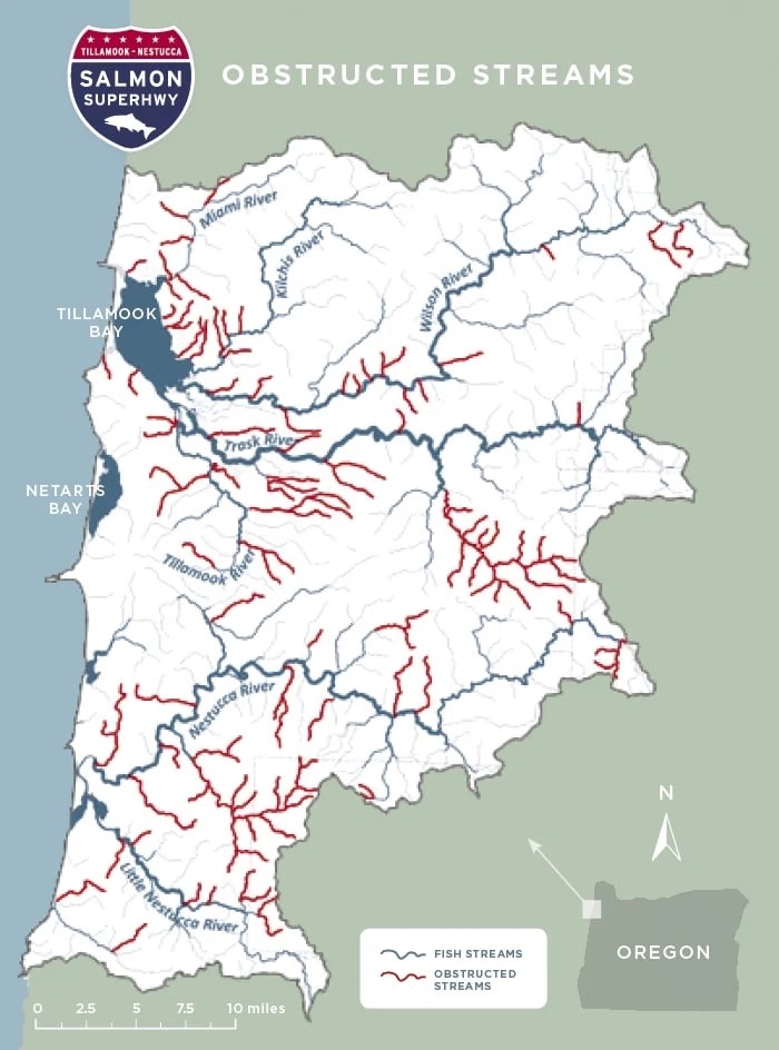
Ransom works for the nonprofit Trout Unlimited and directs a multi-partner project called the Salmon SuperHwy. The aptly named effort got off the ground in 2014, and since then, has been solving two problems at once: removing river barriers to enable salmon and other fish to reach critical upstream habitat, while also reducing flooding that impacts human infrastructure, like roads.
Years ago, more than 300 barriers—mostly culverts—in the coastal watershed were identified as obstructions to the movement of anadromous fish, which are those that migrate from freshwater to the ocean and back. Researchers realized it would take seven decades, and far more money than they could find, to fix them all. So, they built a model and ranked projects with the most habitat that would require the least amount of money, and they found they could restore 95 percent of historic anadromous fish habitat by doing the top 93 projects.
“That opens up a lot of habitat more efficiently,” says Ransom. And more economically.
Since then, the Salmon SuperHwy has been working to connect 180 miles in six major river systems in the Tillamook-Nestucca watershed. The work focuses on six species of anadromous fish, which includes Pacific lamprey and five salmonids—coho salmon, Chinook salmon, chum salmon, steelhead, and cutthroat trout.
All the fish populations are below historic levels, and they’ve faced habitat loss from stream barriers, agriculture, logging, and other developments. Climate change is also contributing to more periods of unfavorable ocean conditions that make food sources less plentiful.
Oregon Coast coho is of special concern. The fish were listed as threatened under the Endangered Species Act in 1998. Their recovery plan set out by National Oceanic and Atmospheric Administration focuses on one major theme: “To protect and restore the freshwater and estuarine rearing habitats that support juvenile survival and overall productivity.”
The Salmon SuperHwy does just that. And Flower Pot Creek is a great example of how.
Road to Recovery
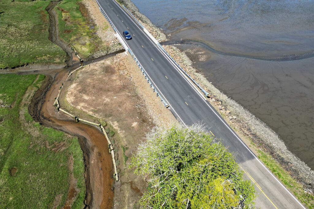
The bridge where Ransom stands spans forty-four feet across Flower Pot Creek’s outlet into Tillamook Bay. Completed in October 2025, the structure replaced a much smaller piece of infrastructure—a four-foot-wide concrete culvert. High flows that surged through this narrow passage created a velocity barrier with water too swift for adult and juvenile fish to navigate. Replacing the undersized culvert with a bridge that allows water to spread out and slow down now opens a door from Tillamook Bay to fourteen acres of tidal wetland that provides critical habitat for young salmon.
When adult salmon return from the ocean to the Oregon Coast, they head up rivers and streams to find spawning habitat. This upstream habitat is also an important cold-water refugia as climate change warms lower elevation waters. Enhanced ability to move around the watershed also helps fish escape fast flows in winter.
How far they can venture depends on what barriers are in their way—and on the unique needs of each species. Coho are upper tributary spawners; they’ll muscle their way up mountain streams into small headwater tributaries. Chinook, on the other hand, like bigger water and chunkier gravel for spawning. They’ll stay in the main stem of a river or its larger tributaries. Chum choose to remain even lower in the system.
Different species of salmon may spawn in different areas, but when the next generation of tiny salmon begin growing larger, they all need the same thing: a safe place to hide from predators and plentiful food.
Places like Flower Pot Creek and its tidal wetland provide the perfect rearing habitat. Fish swim down the rivers where they began life, hit Tillamook Bay, and then can sneak into Flower Pot Creek and pause before heading to the ocean. In the streams and wetlands, young fish will find plenty to eat: aquatic insects, smaller fish, and macroinvertebrates.
“The larger the size of a juvenile fish when it goes out to the ocean, the better its initial chances of survival are,” says Mike Sinnott, assistant district fish biologist with the Oregon Department of Fish and Wildlife, a project partner. This habitat isn’t just critical; it’s also in short supply.
“We’ve lost so many tidal wetlands historically,” he says. “Those are the lands that got drained and turned into agriculture or got developed.”
From Problem to Potential
Dams are among the most recognizable barriers to fish passage. In the last twenty-five years, more than two thousand dams have been removed in the United States, with a hundred dams demolished in the last year alone. But such efforts can be costly, timely, and sometimes controversial. Or impossible.
“A lot of systems have really large dams that make it unfeasible to reconnect habitat,” says Leah Tai, a hydrologist with the U.S. Fish and Wildlife Service, which is one of several federal agencies involved in the Salmon SuperHwy. “But the Tillamook-Nestucca basin has lots of small barriers that are slightly more approachable, so you can really see the habitat gains for the cost.”
Culverts, which allow water to pass under roads, are the most common problem in the watershed. They often look like corrugated metal tubes, and most people drive over them daily and never give them a thought.
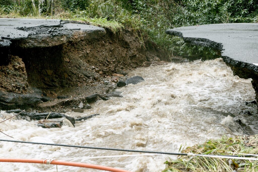
But these small structures can, in fact, cause big problems. Too small, and they create velocity barriers, like on Flower Pot Creek. Too steep, and fast-moving flows can scour away the streambed below, creating a drop that fish can’t leap when headed upstream. Too old, and these metal structures can fail with time, causing washouts. When culverts break apart or fill with debris during storms, water rushes over—instead of below—roads. This can lead to road failures, property damage, and flooding. Ransom says that about 90 percent of the Salmon SuperHwy projects involve dealing with undersized or failing culverts.
“If you look at the news and see a road has washed out, 95 percent of the time, it’s the culvert that’s washed out.”
Chris Laity, Public Works Director for Tillamook County
The county gets an average of ninety inches of rain a year. That helps keep fields green near the coast where the land is flat and dairy farming abounds. But continue east and farmland gives way to the steep slopes of the Coast Range where runoff moves quickly. In recent years, the frequency and intensity of storms has been more severe, as has flooding. It’s made worse where forests have been clear-cut or nothing stops debris from careening downhill.
“In Tillamook County, culverts are the weak point in our transportation system. They’re also the weak point in the salmon migration,” says Laity. The Salmon SuperHwy works to upgrade the size of culverts, replace them with bridges, or in some cases, remove them entirely if they’re no longer needed.
That’s not just a benefit for fish; it helps local residents and businesses. The county’s biggest economic drivers are tourism, dairy farming, and timber—all of which need reliable roads to operate.
“Our roads in Tillamook County were built back in the 1950s when there was lots of timber money,” says Ransom. “But it got harder for the county to keep up with the costs and they didn’t have the capacity to do projects before they failed.” Federal funds from logging in the region used to supply 50 percent of the county’s road budget; that’s dipped now to just 7 percent as the industry has declined.
Now, in partnership with the Salmon SuperHwy, the county can be proactive about infrastructure improvements instead of scrambling to fix what’s broken while a disaster is unfolding, according to Laity.
Seeing Success
After more than a decade of effort, the Salmon SuperHwy is 75 percent complete. Dozens of barriers have been removed, easing upstream passage for adult salmon, and the downstream migration of young fish.
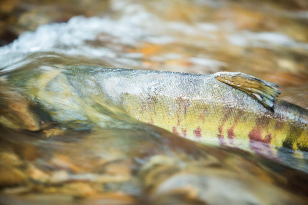
The rehabilitation also helps restore more natural stream flows, which carry sediment and wood downstream where it can contribute to fish habitat, creating areas of cover and pools for resting. Some of the barrier removals also include other restoration work, including realigning stream channels, restoring native plants, designing beaver-friendly habitat, and using more fish-friendly tide gates.
The work has made a noticeable impact on infrastructure. In December 2025, a storm walloped Tillamook and other coastal counties, racking up $15 million in damages across the region, but Laity says Tillamook County didn’t experience culvert failures like they used to. “That means the resiliency worked. We didn’t have to shut down a road for two or three weeks because we have to go out there and get something up and running.” An added bonus? “Radically improved fish habitat,” he says.
Sinnott agrees. Monitoring of completed Salmon SuperHwy projects shows fish are returning quickly. “When we do a fish passage project, we see adults spawning in those streams the year after it’s removed,” says Sinnott. “If there’s habitat there, they’ll find it. They get back and start utilizing those areas pretty much as soon as they’re opened up.”
A Model Project
Oregon’s North Coast is already seeing benefits from the Salmon SuperHwy, and perhaps other places may, too.
“The way our partnership is structured could be done anywhere in other watersheds,” says Ransom. “It could be replicated—and that was the intent from the beginning that this was a pilot project.”
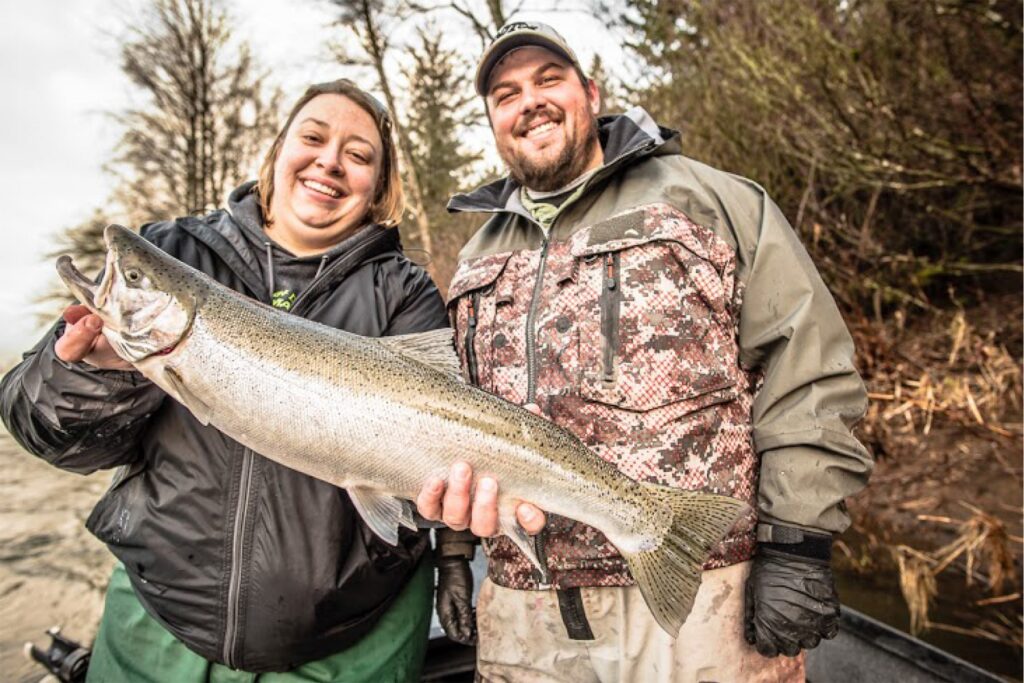
But there are keys to their success that should be heeded. The first is diverse and committed partnerships. The Salmon SuperHwy umbrella includes local businesses, nonprofits, and agencies, including Tillamook County Public Works, Tillamook County Creamery Association, Tillamook Estuaries Partnership, local watershed councils, and Trout Unlimited. State agencies for fish and wildlife, forestry, and transportation, are involved, as well as numerous federal agencies, including U.S. Forest Service, U.S. Fish and Wildlife Service, the Natural Resources Conservation Service, and the Bureau of Land Management.
The coalition ensured expertise on various components of projects but also provided an ability to secure a variety of funding. Funds came from federal grants, including those from the Infrastructure Investment and Jobs Act of 2021 (also known as the Bipartisan Infrastructure Law) passed during the Biden administration. But private foundations, state, and local monies also helped, too.
“Before I got here in 2017, there was angst between the county and environmentalists. They didn’t trust each other. But they saw our need with flooding, and we saw their need with fish, and we aligned. Now it’s no longer ‘us versus them’; it’s ‘win-win.’”
Chris Laity
“Some grants only a government agency can apply for or a nonprofit,” says Laity. “So, we work as a team to bring in the money. That’s been a huge part of it. The Salmon SuperHwy project is for the fish, but it’s also for the people. So, being able to look at it from both lenses has brought in the most support.”
The coalition isn’t just diverse; it’s also consistent. “There’s so much trust and reliability among all the partners,” says Tai. “But that takes years, and the same people in their positions to get to that level.” Having a full-time staff person from Trout Unlimited who’s just focused on overseeing the project has also been key, she says. “That’s something that other watershed councils and groups struggle with—they’re asked to do so many things and are spread so thin,” says Tai. “It’s helped them continue to tick away at the objective.”
At the end of the project, they’ll have a host of metrics to gauge its success—like river miles reconnected, fish population numbers, and infrastructure improvement projects completed—but less concrete has been the noticeable cultural shift that’s underway. “Before I got here in 2017, there was angst between the county and environmentalists. They didn’t trust each other,” says Laity. “But they saw our need with flooding, and we saw their need with fish, and we aligned. Now it’s no longer ‘us versus them’; it’s ‘win-win.’”